


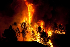
Last year, over 9 million acres were burned in the US alone due to wildfires. While wildfires can be caused by natural events, they often burn out of control and may get to a point where they become uncontrollable, even when managed by firefighters. Despite their sparks of uncertainty and paths of destruction, researchers have found a way to predict wildfire growth through the lifetime of their blazes.
ADVERTISEMENT
<!–/* * Replace all instances of INSERT_RANDOM_NUMBER_HERE with
* a generated random number (or timestamp).
*
* The backup image section of this tag has been generated for use on a
* non-SSL page. If this tag is to be placed on an SSL page, change the
* 'http://ad10.walklightmedia.net/delivery/…'
* to
* 'https://ad10.walklightmedia.net/delivery/…'
*
* This noscript section of this tag only shows image banners. There
* is no width or height in these banners, so if you want these tags to
* allocate space for the ad before it shows, you will need to add this
* information to the tag.
*
* If you do not want to deal with the intricities of the noscript
* section, delete the tag (from … to ). On
* average, the noscript tag is called from less than 1% of internet
* users.
*/–>
… to

Scientists at the National Center for Atmospheric Research (NCAR) in Boulder, Colorado, and the University of Maryland, have developed a technique that combines cutting-edge simulations of the interaction of weather and fire with newly available satellite observations of active wildfires. This is the first time computer modeling offers the promise of continually-updated daylong predictions.
Updated with new observations every 12 hours, the computer model forecasts critical details such as the extent of a blaze and changes in its behavior.
“With this technique, we believe it’s possible to continually issue good forecasts throughout a fire’s lifetime, even if it burns for weeks or months,” said NCAR scientist Janice Coen, the lead paper author and model developer.
“This model, which combines interactive weather prediction and wildfire behavior, could greatly improve forecasting–particularly for large, intense wildfire events where the current prediction tools are weakest.”
Over the last decade, Coen has developed a tool, known as the Coupled Atmosphere-Wildland Fire Environment (CAWFE) computer model, that connects how weather drives fires and, in turn, how fires create their own weather.
Using CAWFE, she successfully simulated the details of how large fires grow.
However simulations need the most updated data because there are so many factors that can change the size and path of a wildfire. This is where satellite instruments come into play.
Coen’s co-author, Wilfrid Schroeder of the University of Maryland, produced higher-resolution fire detection data from a new satellite instrument, the Visible Infrared Imaging Radiometer Suite (VIIRS), jointly operated by NASA and the National Oceanic and Atmospheric Administration.
The new tool provides coverage of the entire globe at intervals of 12 hours or less, with pixels about 1,200 feet across. The higher resolution enabled the two researchers to outline the active fire perimeter in much greater detail.
The researchers said that forecasts using the new technique could be particularly useful in anticipating sudden blowups and shifts in the direction of the flames.
In addition, they could enable decision makers to look at several newly ignited fires and determine which pose the greatest threat.
The breakthrough is described in a paper published this week in the online edition of the American Geophysical Union journal Geophysical Research Letters.
Read more at UCAR.
Wildfire image via Shutterstock.